
Digital Twin Ontario (DTO)
Learn how Ontario is exploring using data and digital-first
approaches to build critical priority public infrastructure faster.
To support Ontario’s growth, the province has committed to spend $220+B on capital projects over the next decade.
However, in Ontario and around the world, delivering infrastructure projects is challenging and complex, even under the best circumstances. Leading jurisdictions are turning to the use of Digital Twins to more efficiently plan, design, and operate infrastructure.
What is Digital Twin?
A Digital Twin is a virtual representation of a real asset or process, across its entire lifecycle, enriched with analytics, which can act as a single source of truth to effectively support more dynamic decision-making, help manage uncertainty and bring greater transparency into options and solutions. It brings value in three areas:
Improving planning decisions – what to build,
where, when and how?
Building better and faster: managing more proactively risks, giving owners the transparency required to make timely decisions, optimize work sequences, reducing friction?
Becoming more efficient in the way existing assets are used and maintained, and optimizing how services are provided and run?
Programs
Hospitals

M-Site
The Peter Gilgan Mississauga Hospital (M-Site) is a critical part of the pTrillium Health Partnerslan to build a new kind of health care that serves our growing and diverse community for the decades ahead. The new hospital will be a full replacement of the existing site and will redefine a new urban centre in this part of the city, focused on health.
Ontario Place
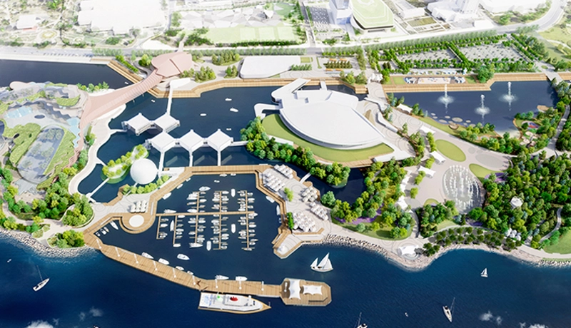
Ontario Place
Infrastructure Ontario (IO) is working with the Ministry of Infrastructure on the future redevelopment of Ontario Place. The first phase of the revitalization vision was completed in June 2017 with the opening of the 7.5 acre Trillium Park and 1.3 kilometre William G. Davis Trail that has successfully transformed a former parking lot into a new waterfront park.
Transit
ECWE – Eglinton CrossTown West Expansion
The Eglinton Crosstown West Extension is an approximately 9.2 kilometre extension of the Eglinton Crosstown LRT, from Mount Dennis to Renforth Drive. The project is being delivered in four large contracts: the Stations, Rail and Systems, Advance Tunnel 1, Advance Tunnel 2 and Elevated Guideway.

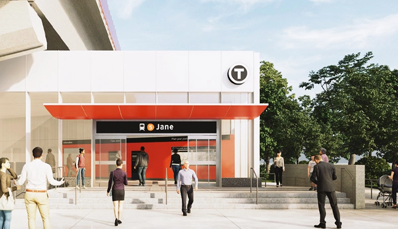
YNE – Yonge North Extension
The Yonge North Subway Extension (YNSE) will extend the TTC’s Line 1 subway service approximately 8 kilometres from the existing terminus at Finch Station into the City of Richmond Hill. The project runs through the City of Toronto and York Region, including sections within the cities of Markham, Vaughan and Richmond Hill.
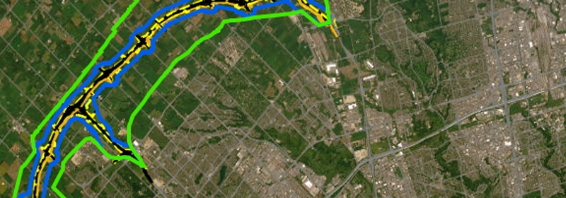
Office of Utility Coordination
The OUC was designed to build and manage dashboards and geospatial data related to the utility coordination processes for the priority transit projects with the goal of engaging utility and municipal partners in a systematic and efficient way.
Utilities

Asset Registry
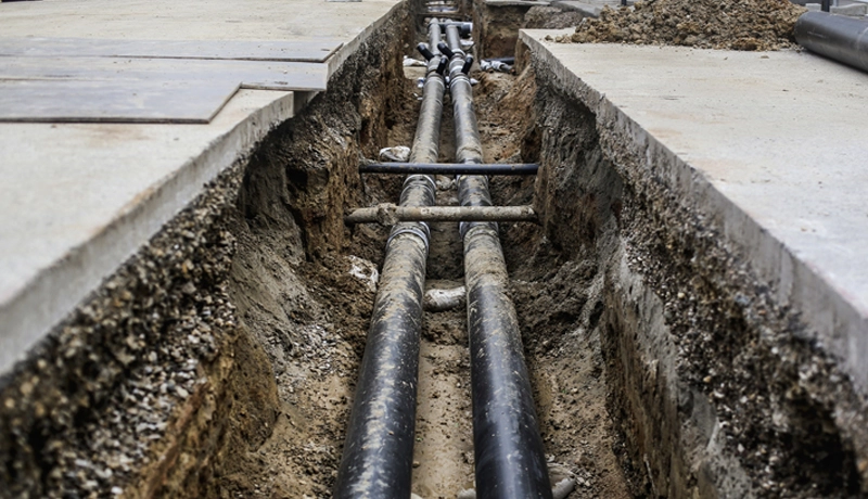
The Geospatial Commission, part of the Department for Science, Innovation and Technology, is building a digital map of underground pipes and cables that will revolutionise the way we install, maintain, operate and repair our buried infrastructure – the National Underground Asset Register (NUAR).
Water
The water distribution system in Ontario operates through an intricate network of water treatment plants, mains (pipelines), and pumping stations that support delivery of safe and potable water to households, businesses, and public facilities…
Coming soon

Distribution Model
Ontario’s utilities distribution model focuses on effective infrastructure management and customer-oriented service. It is based on seamless coordination among utilities (including water and wastewater, electricity, gas, telecommunications and storm water)…

Virtual Power Plants
Virtual power plants (VPPs) are an innovative approach to optimize energy management, ensuring a more resilient power system. VPPs amalgamate capacities from multiple power sources, such as traditional energy sources, renewables…
Coming soon

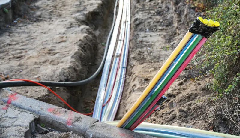
Utility Pole
Bringing high-speed internet to all of Ontario, by fast-tracking the provision of fibre optic high-speed internet to households and businesses in every region of Ontario using existing hydro poles and related infrastructure.
Rural Optimization for Accelerated Deployment (ROAD)
Bringing high-speed internet to all of Ontario, by fast-tracking the provision of fibre optic high-speed internet to households and businesses in every region of Ontario within municipal rights of way.

GIS for Ontario
Geospatial Information System Ontario (“GIS for Ontario”) aims to provide a convening platform for public, private, and non-profit leaders in Ontario to address geospatial-related challenges and explore new ways to use geospatial assets to promote economic growth and social wellbeing.
Coming soon

Utility Manual
In consultation with industry a Utility Manual has been developed. This Utility Manual has the blueprint for government and industry to unlock efficiency and innovation in public infrastructure projects across the province. What’s being proposed in based on global leading practice and will revolutionizes project execution, saving time…
Broadband

One Window (AHSIP)
The government of Ontario has committed nearly $4 billion to connect every region in Ontario to reliable, high-speed internet by the end of 2025.
This is the largest single investment in high-speed internet, in any province, by any government in Canadian history.
Broadband One Window (BOW)
BOW is part of the Designated Broadband Projects from the Government of Ontario to facilitate high-speed internet access for every region of Ontario by 2025. A digital platform for all parties involved in the delivery of high-speed internet services in Ontario to design, procure, construct and manage provincially funded projects to facilitate broadband deployment.
Utility Pole
Bringing high-speed internet to all of Ontario, by fast-tracking the provision of fibre optic high-speed internet to households and businesses in every region of Ontario using existing hydro poles and related infrastructure.
Housing

More Homes
The Ontario government introduced the Cutting Red Tape to Build More Homes Act, 2024, as part of its ongoing commitment to cut red tape, speed up government processes and build at least 1.5 million homes by 2031.

NOAH
NOAH deploys digital twin technology to simulate and strategize for future flood scenarios to aid in developing actionable strategies to mitigate against potential flooding catastrophes
Highways
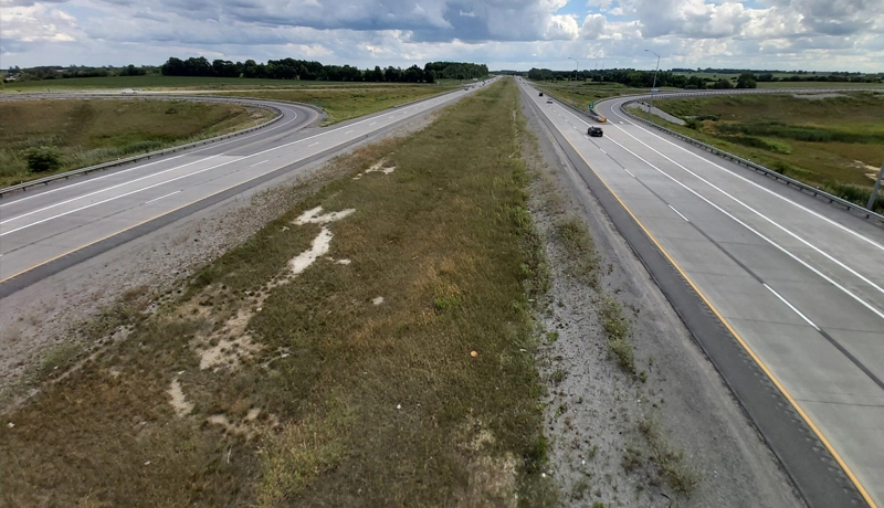
Hwy 413
The proposed 52-kilometre Highway 413 and transitway will extend from Highway 400 (between Kirby Road and King-Vaughan Road) in the east to the Highway 401/407 ETR interchange area in the west, connecting the regions of York, Peel, and Halton. The project includes a 4 km extension to Highway 410 and a 3 km extension to Highway 427 for a total of 59 km for the corridor.
Bradford Bypass
The Bradford Bypass is a 16.3-kilometre controlled access freeway connecting Highway 400 and Highway 404 in the County of Simcoe and Regional Municipality of York. The proposed highway would extend from Highway 400 between 8th Line and 9th Line in Bradford West Gwillimbury, cross a small portion of King Township, and connect to Highway 404 between Queensville Sideroad and Holborn Road in East Gwillimbury.